Your cart is currently empty!
Our Maralinga Tour 2018
“Why of all places, would you want to go to an atomic bomb site?” This comment was directed to us by some people as we made plans to do exactly that just recently this year.
Well, our answer to this was, why not, it is a large part of Australian recent history but also with unfortunate consequences to the health of some of our Aboriginal people and military personnel in later years.
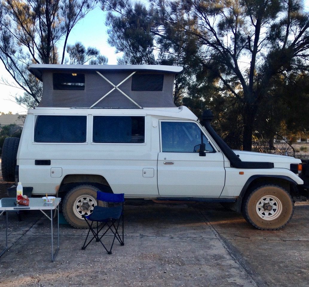
So with all this in mind, we arranged a trip with” Maralinga Tours” and headed off on Friday 13 April 2018 in our venerable 1996 Toyota Land cruiser Troopcarrier on the 4,500 kilometre round trip from our home in Corowa NSW to Maralinga SA. Not quite a “motorhome” as defined in the glossy pages of RV magazines, but a pop top camper with the same comforts, lounge room, dining room, bedroom and kitchen, albeit in a comfy living area of 2 metres X 1.5 metres! Our troopy has taken us to just about every corner and middle bit of this great country over the past twenty years with not a single problem.
Our first stop was a roadside camping spot at Gol Gol having battled strong winds and dust across through Mildura followed by rain, so it was good to pull up and settle down for the evening.
The next day we travelled to Wilmington and camped in the hills before arriving in Port Augusta. On to Ceduna the next day and where we had booked a cabin. We really enjoyed looking around this town and we also did some shopping to stock up on supplies for the journey and for the camping at Maralinga the following evening.
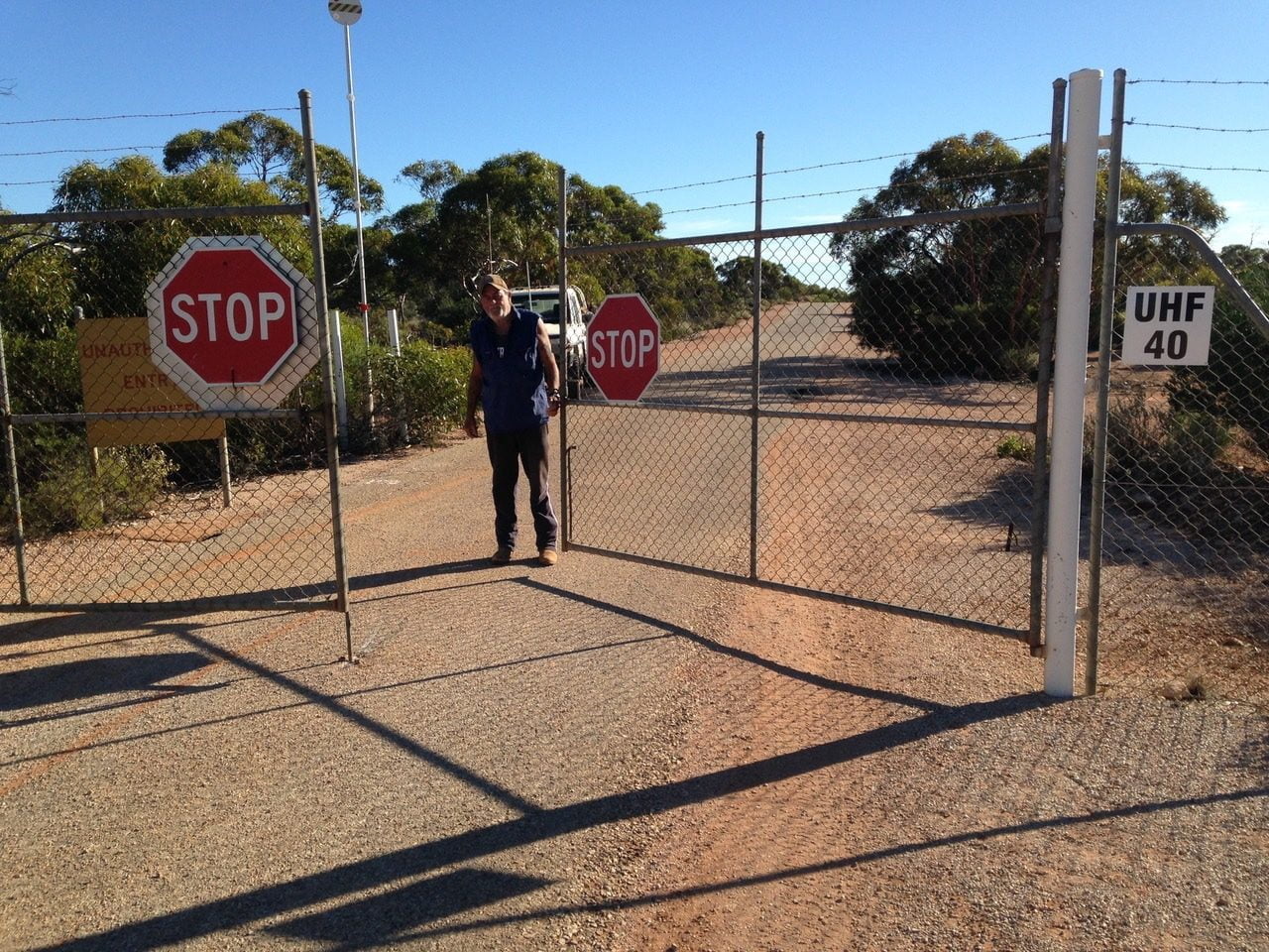
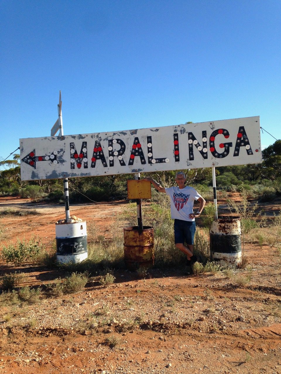
Leaving Ceduna on the Monday morning we motored on 200ks through Nundroo towards Yalata where we turned right on to an unsignposted wide and tar sealed road towards the Iluka mineral sands mine. Along here we crossed the Dog Fence, used to keep out the wild dogs; not sure which side of the fence the dogs are supposed to be though! Just before the mine site is reached, we turned off on a good gravel road for the remaining 90 kilometres to the gate. At the rail crossing at Ooldea, we rang through to our tour guide, Robin, who met us at the gate half an hour later to let us in and guide us to the Maralinga Village to set up camp.
Robin then met with us and the only other two people on the tour (the next tour in two days had seventeen people booked, so we were lucky with a small group) and gave us the rundown for our tour the next day. There are two new and large ablution blocks in the village containing the usual toilets and showers with hot water plus washing facilities if required. There is also a large recreation area contained as well. You don’t really need anything else for your comforts. Of course you need to bring your own food and everything for the couple of nights you will be there.
Next morning we met our guide and the other couple and boarded the 22-seater mini bus for the day’s adventure. We were really excited as to what would be in store! Out we went on a narrow but fully bitumen-sealed road for about 10 kilometres to our first stop at the Maralinga Airport. This has a runway of 2.7 kilometres with a 500-metre runoff at each end and is capable of handling any size aeroplane including a Boeing 747 as well as all military aircraft. The strip is an official emergency landing area if required for all aircraft.
The taxiing area is in itself so big it takes most small aircraft for landing and taking off. The area was designed (by Len Beadell, surveyor and builder of the Gunbarrel Highway) to take the runoff from rain to a nearby dam via a series of concrete drains and which forms all of the Village’s water supply and did in the days when the village housed some 3,000 servicemen, There were no women allowed in Maralinga village due to concerns about their future fertility for baby bearing. The powers that be didn’t seem to worry about the men though!
We had all brought our lunch so a stop was made at the old workshops that were built following the last of the bomb tests. This was near the site of the largest one to be tested, the Taranaki bomb. The workshops were built to house the equipment that was used to dig the huge holes to bury all the contaminated equipment.
After lunch we drove out to the site of two of those monstrous excavations. These are the size of three – yes three MCG (Melbourne Cricket Ground) areas and are about thirty metres deep. In one of those holes all the equipment, towers, buildings, vehicles and anything else was dumped and filled. One of the other holes was used to take all the actual contaminated soil caused by the bomb tests, it too was filled in. The third hole I think was used later on to bury all the excavation equipment itself.
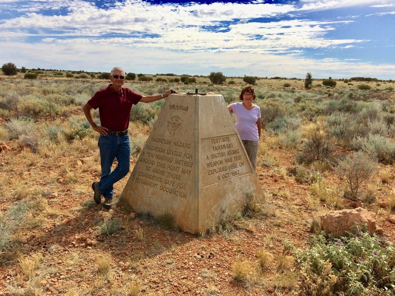
The bombs were tested between 1953/4 and 1965 when the cleanup commenced following the British Government’s decision to stop the tests. There were various reasons for this, one being the political “fallout” (excuse the pun) plus the fact that the nuclear clouds from each explosion was supposed to be blown to the north west of the country but instead blew to the east on the prevailing winds. Someone got it very wrong!
From there we drove to the site of the largest bomb exploded on Australian soil. I might mention here that all the roads we travelled on this day were fully sealed and sometimes went for about 40 kilometres in a straight line with shorter sealed roads going off this main one and which led to each of the other minor tests. There were seven bombs exploded at Maralinga, Taranaki at 26 kilotons being the largest.
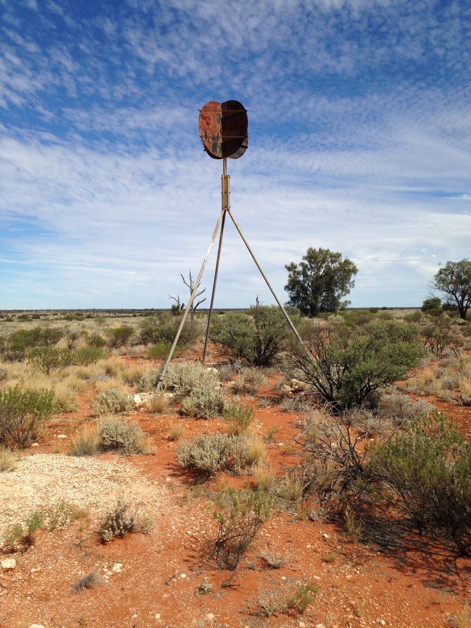
The reason that all roads in the area were sealed was because they were carrying valuable and fragile test equipment and dusty gravel roads were not conducive to smooth travelling.
Soon we were at the Taranaki site, Ground Zero. A concrete monument is atop of the actual spot where this test was conducted. The bomb itself was suspended 300 metres above the ground by barrage balloons and was exploded on 9 October 1957.
From there we visited a few other sites where smaller bombs were tested and eventually arrived back at the village after a full and very interesting day.
The village itself at Maralinga has a small population of the site manager and his family plus Robin, the tour guide, who used to be the site manager and has been at Maralinga since 1972. Robin runs two tours a week and lives at Ceduna. He has an amazing knowledge of the area and its history and a visit is highly recommended.
On Wednesday morning we farewelled our tour mates and Robin who then escorted us to the gate. Our Maralinga tour had ended.
We then travelled south to the rail crossing at Watson where the Indian Pacific train travels east and west. From there we drove 40ks along the railway maintenance track to Ooldea passing the monuments either side of the line dedicated to the joining of the two lines in October 1917. The monuments were dedicated in October 2017, one hundred years later. We carried on then to the crossing at Ooldea where we went over on our way to Maralinga. Daisy Bates lived and worked with the Aboriginal people in this area.
Back down the Iluka Mine road to the Eyre Highway and further to Smoky Bay on the Eyre Peninsula. From there we travelled to Penong, the “Windmill” town where we camped in a park. The following evening we free camped out of Iron Knob and from there into Victoria via Murray Bridge.
Visiting friends in and around Minyip, we also did the “painted silos” run including the impressive, Murtoa No.1 Grain store, also known as the “Stick Shed.” It is a massive storage shed that housed excess wheat grain during World War 2. It has 580 unmilled hardwood poles inside for support and held 92,500 tons of wheat.
Continuing on, we arrived home after another excellent road trip and holiday. Since then we have read some more on the Maralinga testing and the politics behind it. That’s another story!
Subscribe
7 Comments
oldest